Showing posts with label Isoline. Show all posts

Sunday, July 17, 2011

Isopleth

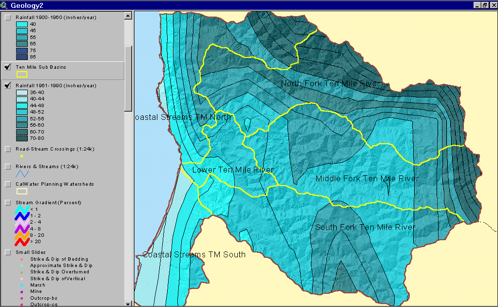
Isopleth maps connect lines to utilize a common variable that has a consistent frequency. Isopleths map phenomenon that cannot be measured at a single point and must be calculated from data over a larger area. This image shows the rainfall isopleths for the Ten Mile River watershed.

Isopach

Isopachs connect areas of equal thickness of a particular stratum. This maps isopachs connect thickness of  Tioga Bentonite over the mid-Atlantic region. The bentonite is the remnant ash from an ancient volcanic eruption in the area. 

Isohyets

Isohyets are yet another type of isolines that is used to connect areas of equal rainfall. This particular map shows the annual average precipitation in the state of Texas, you can see that wind patterns tend to push the rain fall westerly. 

Saturday, July 16, 2011

Isotachs

Isotachs use isolines that connect areas of equal wind speed. This map looks at the wind speeds in the North Eastern U.S., stronger wind speeds are found further south on this map while the north has greater variance/sharper gradients in wind speed.

Isobars

Isobars are used to connect area of equal averaged pressure on a map. The pressure is reduced to sea level and not the surface pressure of an area in an attempt to have a base pressure. This is a weather forecast in the Great Lakes area.

Thursday, July 14, 2011

Isoline Maps

http://www.srh.weather.gov/jetstream/synoptic/ll_analyze_slp_soln.htm 
An isoline map is a map with continuous lines joining points of the same value. This one connects the barometric pressure of the atmosphere, while the pressure most likely fluctuates somewhat connecting it with an averaged isoline helps give the viewer a decent perspective on the changes.