Showing posts with label Topographic Map. Show all posts

Sunday, July 17, 2011

DEM

DEM stands for digital elevation model and is a digitally rendered topographic map. This map depicts the Lake Tahoe basin and could be used to track water movement and change in depth of the lake. DEM's have a number of uses and provide a clear and detailed picture of an area.  

DRG

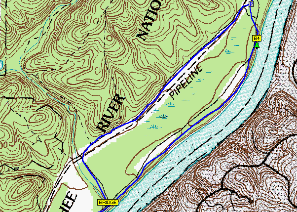
A digital raster graphic is a topographical map that has been scanned and then georeferenced to the contour of the Earth. This map utilizes contour lines to express the topography of the area surrounding the river's flood plane, the map also shows man made features such as the pipeline that runs along the marshland near the river.

Monday, June 20, 2011

Topographic Map

Topographic maps show changes in elevation using either shading or contour lines, this usually depicts a relatively large area. This particular map depicts the Italian peninsula and surrounding areas. The changes in elevation are depicted by shading that is defined by the legend on the upper right side. Areas along the coast tend are of lower elevation than the middle line of the country and you can see the Alps at the top of Italy that have the highest elevation on this map.